|
Highway 401 is recognized as a key economic corridor. It provides access within the Greater Toronto Area, across Ontario and to the U.S.A. through border crossings at Windsor and Sarnia. In 2005, Highway 401 carried a commodity value of $ 900 M per day through the project limits. Safe and efficient goods movement plays an important role in this transportation corridor.
The Ministry is currently undertaking a number of studies to examine broader transportation initiatives such as transit and high occupancy vehicle facilities. This included the Class Environmental Assessment (EA) Study for improvements to Highway 401 from east of the Credit River to east of Trafalgar Road (9.7km). The purpose of this study was to identify the interim and ultimate capacity for this section of Highway 401 and to consider provisions for high occupancy vehicle lanes (HOV) and transit.
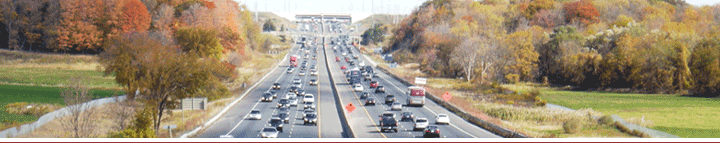
AECOM Canada Ltd (AECOM) has been retained by the Ontario Ministry of Transportation (MTO) to undertake the Detail Design project for the widening of Highway 401 from the Highway 403/410 interchange to the Credit River in the City of Mississauga, Regional Municipality of Peel, a distance of 7 km.
The project section of Highway 401 is currently a 6 lane divided freeway. East of Highway 410/403, a 12-lane express collector system is in place. A portion of Highway 401 is currently under construction for widening to a 12-lane core/collector system from Highway 410/403 to west of Hurontario Street, including reconstruction of the Hurontario interchange (Contract #2009-2031).
This project will carry forward the issues and commitments identified as part of the August 2005 Transportation Environmental Study Report (TESR) (Approved, 2007), which identified design improvements for this section of Highway 401. This includes:
- Widening of Highway 401 to a 12-lane core/collector system from west of Hurontario Street to the Credit River;
- Construction of HOV lanes in both directions;
- Reconstruction or extension of the Mavis Road interchange;
- Removal of the 2nd Line West structure;
- Culvert extensions at Fletcher’s Creek; and
- Expansion of COMPASS system
A key component of addressing these issues is through consultation. Further information about the consultation program is in the Upcoming Events section.
 |
Please Note: In some cases you will require Adobe Acrobat Reader to view these files. Click here on the link below to download this software. |
|